
Tour de Leaf
San Francisco Peaks, October 9, 2004
Jeff and Steele
We hit the peak of Flagstaff's fall colors on what we hope will become an annual event. I left Mars Hill at 9:30 and swung by Steele's place at 9:40; from there we headed up Rt. 180 to Schultz Pass Road, up Schultz Creek Trail, and up the Waterline Road to its bikeable terminus at Aubineau Canyon.
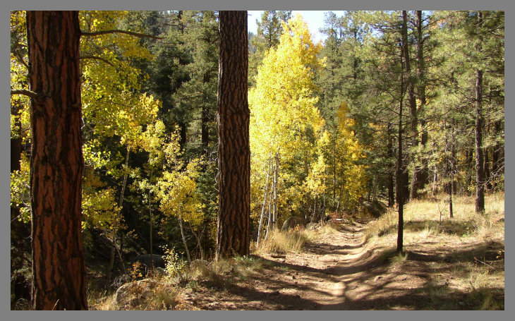
7650' - Schultz Creek Trail
By this time of year, the aspens are turning regardless of elevation. This is looking back downhill on Flagstaff's very best mountain biking trail, a 4-mile stretch of curvy singletrack that's a fun fitness spin going up, and an exhilarating speedway coming down. Here we were taking a break on the way up; five hours, 100 oz of liquid, and four energy bars later, later we were cruising back down it.
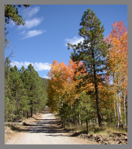
8100' - The Waterline Road
The road that goes farthest up the Peaks is an old dirt road that municipal vehicles use to get to the wells drilled into Inner Basin area. Here we had just turned up the road, and we promptly found a stand of aspens that was turning fiery red.
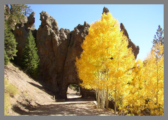
8300' - Rock Fins
The Waterline Road meanders around with the topography of the mountain, swooping into canyons and then back out around the edges of huge fins of rock. In one place, there is only one option for getting by the outcropping!
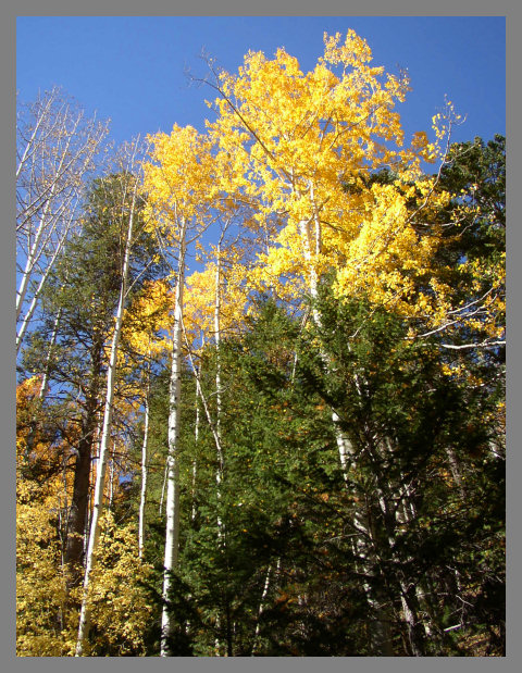
8450' - Old Growth Aspens
Higher on the flanks of the peaks are spectacularly beautiful aspens, with trunks perhaps a foot thick. Around almost every bend in the road was scenery like this.
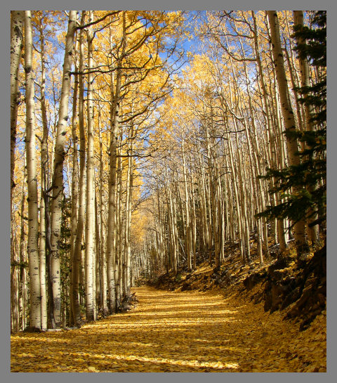
9150' - Golden Tunnel
Here is a defining feature of this ride. High on the mountain, the aspens are losing their leaves. If you catch it just right, as we did on this day, you reach a stretch of about a mile where many leaves have fallen and many are still on the trees. The road is carpeted in fallen leaves, and with the remaining foliage and the yellow light of a fall afternoon, the entire world turns gold.
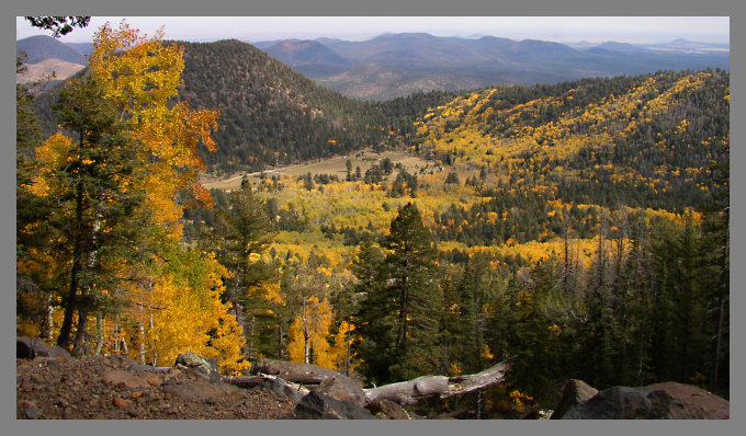
9600' - Lockett Meadow
Above "the cabins" at the junction of the Waterline Road and the Inner Basin Trail, you can look down on Lockett Meadow, a popular recreation area. In the distance are the cinder cones of the San Francisco volcanic field. Far away to the east, the Painted Desert is just visible.
10400' - Aubineau Canyon
We made it! The Waterline Road ends at the top of Aubineau Trail, with other trails leading farther up into the peaks -- but these other routes are all in the Kachina Peaks Wilderness and are off limits to bikes. A very nice pair of hikers recorded the end of our climb. We're wearing jackets, which we put on at the cabins. It was 70 in Flagstaff, but 55 up at the top. In the distance, the North Rim of the Grand Canyon was clearly visible. The tan expanse of the arid Coconino plateau between Flagstaff and the Grand Canyon, some 4000' below us, can be seen where the cinder cone field ends.

From Mars Hill, this ride was 5 hours 28 minutes, 46.5 miles, and over all the ups and downs, a total ascent of 3,650 feet. Till next year!
[ Home page | Travelogue summary page ]